Friday, August 30, 2013

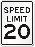
Should Main Street be a 20 MPH street?

Main Street is Laurel's original commercial corridor and currently the only stretch of retail/office that was designed for walk-up traffic.  It has wide sidewalks (up to 10' including the tree boxes).  It is a designated bike route in the City.  The buildings are not set back from the property lines and there are no parking lots in between the road and the building entrances.  In short, it was designed for the people that live on and adjacent to Main street - like a traditional city.  It, however, has a speed limit of 25 mph, which is often the default lowest speed limit assigned to roads.  Residents have often stated that drivers were going too fast on Main Street.  Data shows that the average speed is about 22 MPH with 70% of the traffic traveling below the speed limit. However, a better question may be:  Is 25 mph the correct speed limit for Main Street?

A trend that has been developing in Europe and is just beginning here in the US, is 20 mph streets.  Typically, 25 MPH is the default minimum – often reserved for residential roads, but based largely on the design speed that the roadway was designed for. Somerset, MD, a small lovely residential hamlet in Montgomery County, has made a policy decision to reduce the speed limit for the entire town to 20 MPH. 
This decision was not an engineering one (which typically deals with only the safety of drivers that are already pretty safe wrapped up in a 3000 lb steel box).  Rather, it was a decision based on planning for slower roads and roads that are safer for all users (children, joggers, cyclists, etc.). 
Some of the the positives and negatives of a slower Main Street are:
Positives:
·       Slower speeds making walking more comfortable for pedestrians.
·       Slower speeds are better for bikers (speed differential between cars and bike is a main factor in bicycling level of comfort and broadening its appeal to more users.
·       A pedestrian getting hit at 25 mph has 4-fold higher likelihood of dyeing than at 20 mph.
·       Slower drivers are more apt to see the types of businesses that line Main Street.
·       There is simply no engineering reason to allow/encourage 25mph speeds on Main Street, but there are certainly economic and safety reasons for lowering the speed limit.
Negatives:
·         A driver will need an extra 23 seconds to travel the main retail stretch from MD 216 to US 1.
That’s it.  On the surface, relying on planning and policy, rather than what a roadway could handle, sure seems to be a better way for towns to assign speed limits.


Saturday, August 3, 2013

Links edition


  • Bikes are great for business.
  • Even drivers want separate bike lanes.
  • 124 bike racks last year!  Nicely done, Hyattsville.
  • Takoma Park gets $2.3M for bike lanes and sidewalks.  The money quote is here: “To find out that not only were we the only ones to be awarded in Maryland, we were the only ones who submitted — It’s huge.”
  • Walkability is good for town coffers.
  • My single favorite planning/transportation/land-use topic:  Placemaking. I highly recommend the book, if only for its coffee table value.  Every time I pick it up, I think about Gude Park's potential.

Tuesday, July 30, 2013

Tour de Laurel

Finally got around to biking the entire City (existing and planned routes) all at one shot. Sunday morning was perfect for it.  Pictures of the lovely mill town are below, but first some observations:
  • Riverfront Park is such a jewel for the City - it can't be lengthened fast enough.
  • Main Street - despite being 150 years old and the only walkable and bikeable commercial corridor in the City (and a city-designated bike route) - has not one single bike rack.  Unexcusable.
  • The City streets are very easy to bike in with traffic.  The designated routes are slow and drivers allow you to take the lane. 
  • The access path from Cherry Lane to Gude Park is awesome and easier to get up and down than it looks.  It still looks good after a few years - the crew that built it must know a thing or two :)
  • Biking on Route 1 is terrifying. But the sidewalks are too narrow and have people walking on them.  It's a shame the stores don't address the street, but instead plop a giant ugly parking lot between the entrance and the City's walkers and bikers.  The zoning code needs to be changed to mandate rear parking and no front yard setbacks.
  • The Laurel Place and Mulberry Street bike lanes will really tie the north-south network together nicely.
  • There are stretches of the Gude Lake path that could use a bit of smoothing and widening - particularly on the north side.
  • The City shold adopt the Idaho Stop.  There is simply not enough vehicle traffic in the City (and too many stop signs) for it not to be adopted.
  • Please remove the unwarranted stop sign at 4th and Marshall - what a buzz kill for cyclists heading to Main Street (and cars, I'm sure).
  • Bowie Road between the tracks and Route 1:  U.G.L.Y.  Gravel shoulders and zero sidewalks.  That should be priority number 1 on the CIP. The ROW can hold two 10' lanes and buffered bike lanes on each side, plus sidewalk and trees.
  • The wayfinding signage around town is nice and it should be added with any new lanes that get built.
  • The signal at 4th and Cherry needs a couple of extra seconds added to the southbound minimum green setting.  Not quite enough time for a cyclists to completely cross prior to the main line getting a green. This could be quite the liability for the City and should be address ASAP.
  • All in all, a very enjoyable and quick ride.
The photos:
The original Laurel Dam

The mighty Patuxent

Winding riverfront path

Laurel Marc Station.

New sharrows on Lafayette

Ye olde Laurel Mall

4th Street looking almost chic. How about some knock-out roses to liven up the median?

Cherry Lane ped/bike access ramp

Gude Park trail and banners

Left side bike lane

Laurel Community Garden

6th Street - the old streetcar ROW (that's why it's so wide)

Seems too specific. Can deer read?

Saturday, February 23, 2013

Bike Routes, by Comfort Level

This map below shows Laurel's preferred bike routes, color-coded by ease of ride-ability. Blue Routes are residential collector roads - very easy to bike in the street with low traffic volume and low speeds. Novice riders should feel comfortable riding in the street.  Green Routes have slightly more traffic volume but are easy to ride because they have bike lanes and/or wide shoulders and/or low speeds.  Yellow Routes have moderate volume and speeds but should still provide a level of comfort for the average rider.  Red Routes are high-volume with either high speeds or narrow lanes.  These are not for average riders. Click on each colored link to find a brief description of the Route.  Finally, the little bike symbols show where bike parking can be found.


View bicycle level of comfort City of Laurel, MD in a larger map

Sunday, March 4, 2012

Links Edition - developing the smart way

Haven't had the time to update this Blog as frequently as I would like.  In reality, I see it morphing toward editorializing and discussion of best practices, rather than an update/discussion on Laurel-specific plans (tough to do the latter when you're no longer in the know).  Strangely, this site gets 300 to 400 hits a month still, mostly from people researching pedestrian and bike safety/infrastructure. Kind of flattering for the City, no?  Regardless, here are some links to articles I've finally gotten around to reading that may be informative to those that still come here:

Sunday, January 1, 2012

Year in review; and some new ideas, too!

The following is a quick review of pedestrian & bike capital improvements in Laurel. The City:
  • added bike lanes on Cypress Street, including the City’s first bike box.
  • added sidewalk on 7th Street in Old Town.
  • added Laurel Lakes Drive near the Safeway.
  • added a 8’ wide hiker-biker trail on Van Dusen, south of MD 198.
  • added bike sharrows on Laurel Lakes Drive
  • widened the sidewalk on a large portion of Cherry Lane to 8’ wide.
  • Brooklyn Bridge Road was resurfaced by the County with wider shoulders near the gully. The wider shoulders make it easier on bikers and joggers.
  • MD SHa, at the City’s behest, installed sidewalk on Route 1 south of Cypress, completing the sidewalk network for the entire length of Route 1 in the City.
  • The bike lanes on 4th Street were completed
  • Bike parking was added to City Hall and to the new 5th Street Community Center.
  • Decorative period-style sign posts and sign backers were installed on parts of Main Street.
  • The crosswalks were widened on Cherry Lane at 4th Street.
Very good year for those not dependent on their cars.  Now, let’s keep up the momentum by:
  • Installing bike lanes on the Mulberry and Laurel Place to complete the north-south bike route through the entire city.  Conceptual plans have already been drawn up and can be incorporated into the CIP’s resurfacing project for both roads.
  • Updating policy and infrastructure goals/designs of the City’s Bike Masterplan.  This should be a winter-time project. I volunteer to lead the public hearings, draft  any policy changes and create the visuals, if need be.  But given that the masterplan is now attached to the City’s Uniformed Land Development Code, it is imperative to keep this plan updated and fresh.
  • Prohibit parking on Laurel Place. 
  • Consider policy changes that allow bicyclists to treat stop signs as yield signs and signals as stop signs.
  • Installing cycle-tracks on Van Dusen and buffered bike lanes on Cherry Lane.
  • Completing the 8' trail south of the dog park.
  • Planting more shade trees along existing trails.
  • Finding a way to get more bus shelters in place – too many “sticks in the ground” are posing as bus stops, without shelters or even sidewalk leading to the stop.  This needs to change if we are going to encourage alternative transportation modes.
Have a great 2012, Laurel!

Thursday, November 3, 2011

Transit Improvements in Laurel

While this blog is oriented toward pedestrian and bike infrastructure (and its role in planning and the creation of a sophisticated modern city), there is another transportation mode that are no less important to cities: transit.  Two important transit improvements are coming (in a couple of years) that will help those that rely on the Metro bus or MARC trains.  The first piece of news is that MTA is adding capacity to the MARC lines via more cars.  The second piece of (old) news is that WMATA was awarded a TIGER grant last year to improve bus travel time on several routes, including Route 1 from Laurel down into DC (2MB PDF).  Bus travel time improvements include Transit Signal Priority (TSP) and Queue Jumps.  TSP allows buses to get through an intersection faster than they normally would by adding green time or truncating green time from cross streets.  Queue Jumps provide space for buses to get ahead of a queue of cars (so that there actually is a potential time advantage to using a bus over driving yourself).

Both MARC and WMATA improvements are scheduled for a couple of years out, but are very welcome nonetheless.

Monday, October 17, 2011

Real-time traffic in Laurel

Zoom and Pan within the map.


Sunday, October 9, 2011

Doing Parking Islands the right way

Laurel has a lot - a LOT! - of surface parking.  These lots collect stormwater (and motor oil and antifreeze and debris) and send them directly into the nearby Patuxent river, and eventually into the Chesapeake. While treating all this stormwater prior to it reaching the river is expensive, there is a ubiquitous tool that can treat some of it :  the humble parking island.
Old style parking islands 
But instead of making them like the one above, for the same amount of money, they can be made like these:
"Green" parking islands
Capturing & treating run-off before it enters storm water inlets (photo credits: Lisa Zimmerman)
These parking islands are slowly becoming more common. They capture filter run-off from moderate storms. The only main difference between these "green" islands and traditional ones is 1) the use of rocks to slow down and capture water flow; 2) the types of plants that go in the island.

With a new Walgreens coming to town, and a new (reconfigured) parking lot,  the City presently has the opportunity to try and start "greening" some its parking lots.

Tuesday, September 13, 2011

US Route 1 Sidewalk gap to be filled

There has been a long-standing gap in the sidewalk network along the City's main north-south commercial corridor, Route 1. This gap is the section along Route 1 in the southern part of the City between the Contee Shopping Center and the rest of the City north of Braygreen Road.  See picture below taken from the City's Bike MasterPlan.
Only sidewalk gap on Route 1.
DPW requested sidewalk from the State about a year ago.  The State obliged and is putting in a new 5' sidewalk, with a 4' buffer between the sidewalk and road. The buffer provides room for further expansion to a full fledged hiker-biker trail that meets up with the City's existing designated bike routes (and ideally will go all the way down to Muirkirk Station and College Park, one day). This new sidewalk is a big feather in the City's cap, as it completes the sidewalk network for the entire Route 1 corridor (on the west side, at least).  Well done DPW  - you've made a lot of people safer and made their trips more convenient.

On a different note, posts on this Blog will be much more infrequent, as I am no longer in the City's employ.  Hopefully, the City will grant me the opportunity to volunteer in whatever capacity I may be of service.  Thank you Laurel; it has been an honor to work for you.

Tuesday, August 30, 2011

Bike Sharrows on Laurel Lakes Ave

As part of the City's Bike Masterplan, Laurel Lakes Avenue and Cypress Street were designated as preferred Bike Routes through the City.  As shown below, both Streets were marked with sharrows and signed as Bike Routes.

Bike Guide sign on Cypress, directing cyclists onto Laurel Lakes Ave for access to points south on Route 1.

Sharrows on Laurel Lakes Ave. Sharrows are located such that cyclists won't be doored by parked cars, yet motorists can still easily maneuver around them, if needed.
These two streets bring the City a little closer to having a complete north-south route the full length of the City, providing access to the commercial Route 1 corridor without requiring cyclists to actually ride on Route 1.

Thursday, August 25, 2011

Hiker-Biker Trail on Van Dusen

Contractors for the City of Laurel are putting the finishing touches on an 8-ft wide trail along Van Dusen Road, from MD 198 to North Arbory Court. Here is what the heavily-worn area looked like before:
Van Dusen, before the new hiker-biker trail
Here is what the upgrade - already lined with shade trees - looks like now:
New 8' sidewalk along Van Dusen Road
Comments from passers-by have been overwhelmingly positive!

Tuesday, August 23, 2011

Yes, that was an earthquake in Laurel

But no, it didn't stop ongoing pedestrian and bike projects around town.  Currently, there are two projects underway.  The first is the marking and signing of Laurel Lakes Ave as a designated bike route.  The second project is the installation of a new 8' wide hiker bike trail along Van Dusen Road.  More on both of these important projects to follow.

Thursday, August 11, 2011

Bike Box

This is a photo of Laurel's first intersection bike box.  It was installed with the Cypress Street bike lanes.
Left-turn Bike Box on Eastbound Cypress at Mulberry
The left-turn bike box provides a safe area for cyclists to wait out approaching traffic from westbound Cypress, without fear of being rear-ended by motorists behind them.  The sketch below shows this a bit more clearly.
Sketch showing the two ways that a cyclist can turn left onto Mulberry from Cypress
From the sketch above, an eastbound cyclist traveling in the full lane of Cypress Street can make a quick and easy left turn onto Mulberry* (solid green line) assuming there is no westbound traffic on Cypress.  If there is westbound traffic, the cyclist must wait (like any vehicle) in the intersection until westbound traffic has cleared (dotted green line).  The box delineates a safe area where cyclists are protected from westbound traffic heading toward them, as well as from eastbound traffic coming up behind them.

*Bike lanes will be installed on Mulberry as part of that street's Capital Improvement Project, currently slated to begin next spring.

Bike Lanes on Cypress Street

New bike lanes have been installed on Cypress Street from Oxford Drive to Mulberry Street.  The bike lanes are 6 feet wide.  8-ft parking lanes have been delineated, as well.
New Bike Lanes on both sides of Cypress St.
Because Cypress Street is a collector road for the Vistas, the Tiers, Oak Pointe, as well as the Wellington neighborhoods, it sees a good deal of vehicle traffic; so separating out the bike lanes for this short stretch provides for a safer biking trip.