Showing posts with label biking. Show all posts

Friday, August 30, 2013

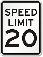
Should Main Street be a 20 MPH street?

Main Street is Laurel's original commercial corridor and currently the only stretch of retail/office that was designed for walk-up traffic.  It has wide sidewalks (up to 10' including the tree boxes).  It is a designated bike route in the City.  The buildings are not set back from the property lines and there are no parking lots in between the road and the building entrances.  In short, it was designed for the people that live on and adjacent to Main street - like a traditional city.  It, however, has a speed limit of 25 mph, which is often the default lowest speed limit assigned to roads.  Residents have often stated that drivers were going too fast on Main Street.  Data shows that the average speed is about 22 MPH with 70% of the traffic traveling below the speed limit. However, a better question may be:  Is 25 mph the correct speed limit for Main Street?

A trend that has been developing in Europe and is just beginning here in the US, is 20 mph streets.  Typically, 25 MPH is the default minimum – often reserved for residential roads, but based largely on the design speed that the roadway was designed for. Somerset, MD, a small lovely residential hamlet in Montgomery County, has made a policy decision to reduce the speed limit for the entire town to 20 MPH. 
This decision was not an engineering one (which typically deals with only the safety of drivers that are already pretty safe wrapped up in a 3000 lb steel box).  Rather, it was a decision based on planning for slower roads and roads that are safer for all users (children, joggers, cyclists, etc.). 
Some of the the positives and negatives of a slower Main Street are:
Positives:
·       Slower speeds making walking more comfortable for pedestrians.
·       Slower speeds are better for bikers (speed differential between cars and bike is a main factor in bicycling level of comfort and broadening its appeal to more users.
·       A pedestrian getting hit at 25 mph has 4-fold higher likelihood of dyeing than at 20 mph.
·       Slower drivers are more apt to see the types of businesses that line Main Street.
·       There is simply no engineering reason to allow/encourage 25mph speeds on Main Street, but there are certainly economic and safety reasons for lowering the speed limit.
Negatives:
·         A driver will need an extra 23 seconds to travel the main retail stretch from MD 216 to US 1.
That’s it.  On the surface, relying on planning and policy, rather than what a roadway could handle, sure seems to be a better way for towns to assign speed limits.


Saturday, February 23, 2013

Bike Routes, by Comfort Level

This map below shows Laurel's preferred bike routes, color-coded by ease of ride-ability. Blue Routes are residential collector roads - very easy to bike in the street with low traffic volume and low speeds. Novice riders should feel comfortable riding in the street.  Green Routes have slightly more traffic volume but are easy to ride because they have bike lanes and/or wide shoulders and/or low speeds.  Yellow Routes have moderate volume and speeds but should still provide a level of comfort for the average rider.  Red Routes are high-volume with either high speeds or narrow lanes.  These are not for average riders. Click on each colored link to find a brief description of the Route.  Finally, the little bike symbols show where bike parking can be found.


View bicycle level of comfort City of Laurel, MD in a larger map

Sunday, March 4, 2012

Links Edition - developing the smart way

Haven't had the time to update this Blog as frequently as I would like.  In reality, I see it morphing toward editorializing and discussion of best practices, rather than an update/discussion on Laurel-specific plans (tough to do the latter when you're no longer in the know).  Strangely, this site gets 300 to 400 hits a month still, mostly from people researching pedestrian and bike safety/infrastructure. Kind of flattering for the City, no?  Regardless, here are some links to articles I've finally gotten around to reading that may be informative to those that still come here:

Sunday, January 1, 2012

Year in review; and some new ideas, too!

The following is a quick review of pedestrian & bike capital improvements in Laurel. The City:
  • added bike lanes on Cypress Street, including the City’s first bike box.
  • added sidewalk on 7th Street in Old Town.
  • added Laurel Lakes Drive near the Safeway.
  • added a 8’ wide hiker-biker trail on Van Dusen, south of MD 198.
  • added bike sharrows on Laurel Lakes Drive
  • widened the sidewalk on a large portion of Cherry Lane to 8’ wide.
  • Brooklyn Bridge Road was resurfaced by the County with wider shoulders near the gully. The wider shoulders make it easier on bikers and joggers.
  • MD SHa, at the City’s behest, installed sidewalk on Route 1 south of Cypress, completing the sidewalk network for the entire length of Route 1 in the City.
  • The bike lanes on 4th Street were completed
  • Bike parking was added to City Hall and to the new 5th Street Community Center.
  • Decorative period-style sign posts and sign backers were installed on parts of Main Street.
  • The crosswalks were widened on Cherry Lane at 4th Street.
Very good year for those not dependent on their cars.  Now, let’s keep up the momentum by:
  • Installing bike lanes on the Mulberry and Laurel Place to complete the north-south bike route through the entire city.  Conceptual plans have already been drawn up and can be incorporated into the CIP’s resurfacing project for both roads.
  • Updating policy and infrastructure goals/designs of the City’s Bike Masterplan.  This should be a winter-time project. I volunteer to lead the public hearings, draft  any policy changes and create the visuals, if need be.  But given that the masterplan is now attached to the City’s Uniformed Land Development Code, it is imperative to keep this plan updated and fresh.
  • Prohibit parking on Laurel Place. 
  • Consider policy changes that allow bicyclists to treat stop signs as yield signs and signals as stop signs.
  • Installing cycle-tracks on Van Dusen and buffered bike lanes on Cherry Lane.
  • Completing the 8' trail south of the dog park.
  • Planting more shade trees along existing trails.
  • Finding a way to get more bus shelters in place – too many “sticks in the ground” are posing as bus stops, without shelters or even sidewalk leading to the stop.  This needs to change if we are going to encourage alternative transportation modes.
Have a great 2012, Laurel!

Tuesday, August 30, 2011

Bike Sharrows on Laurel Lakes Ave

As part of the City's Bike Masterplan, Laurel Lakes Avenue and Cypress Street were designated as preferred Bike Routes through the City.  As shown below, both Streets were marked with sharrows and signed as Bike Routes.

Bike Guide sign on Cypress, directing cyclists onto Laurel Lakes Ave for access to points south on Route 1.

Sharrows on Laurel Lakes Ave. Sharrows are located such that cyclists won't be doored by parked cars, yet motorists can still easily maneuver around them, if needed.
These two streets bring the City a little closer to having a complete north-south route the full length of the City, providing access to the commercial Route 1 corridor without requiring cyclists to actually ride on Route 1.

Thursday, August 25, 2011

Hiker-Biker Trail on Van Dusen

Contractors for the City of Laurel are putting the finishing touches on an 8-ft wide trail along Van Dusen Road, from MD 198 to North Arbory Court. Here is what the heavily-worn area looked like before:
Van Dusen, before the new hiker-biker trail
Here is what the upgrade - already lined with shade trees - looks like now:
New 8' sidewalk along Van Dusen Road
Comments from passers-by have been overwhelmingly positive!

Thursday, August 11, 2011

Bike Lanes on Cypress Street

New bike lanes have been installed on Cypress Street from Oxford Drive to Mulberry Street.  The bike lanes are 6 feet wide.  8-ft parking lanes have been delineated, as well.
New Bike Lanes on both sides of Cypress St.
Because Cypress Street is a collector road for the Vistas, the Tiers, Oak Pointe, as well as the Wellington neighborhoods, it sees a good deal of vehicle traffic; so separating out the bike lanes for this short stretch provides for a safer biking trip.

Tuesday, July 12, 2011

New Pedestrian and Bike Regulations in City Code

As of July 1st, the City of Laurel has adopted a Unified Land Development Code. This new code consolidates and replaces the existing zoning ordinance, subdivision regulations, forest conservation codes, and all other development-related regulations.  Several particular changes have been made in the Code with regard to the way that new developments accommodate and mitigate traffic.  Specifically, developments will now have to accommodate pedestrian and bicycle travel, in addition to the vehicle traffic that developments have traditionally been required to mitigate.  These changes will help provide alternative choices for City residents to get around town. The changes are as follows:
  1. Sec. 20-2.2. (b)(3)  Requires traffic impact studies to look at the effects of bike and pedestrian traffic generated to and from new developments, instead of only vehicle traffic. This will insure that traffic mitigation, if needed, applies to pedestrian and bike traffic, instead of just car traffic.
  2. Sec. 20-16.12. (b), (g)  Reduces and/or consolidates the number of parking lot driveways during redevelopment projects. The purpose of this change was to reduce the number of conflict points the lead to crashes - for cars and for bikes and pedestrians.
  3. Sec. 20-31.5. (b)  All new blocks are now limited in length to 500 feet. The previous limit was 1400 feet. This change encourages shorter blocks to reduce the likelihood of mid-block crossing in commercial areas that get a lot of pedestrian traffic.
  4. Sec. 20-31.1. (c)  For new developments, minor streets are to be designed such that speeding is discouraged. Potential methods, offered by the Code, include traffic calming, sharp corner radii, narrow streets, and bump-outs at intersections. By providing for traffic calming in the design process, it prevents the City from going back and having to retro-fit a speed reduction fix into a neighborhood.
  5. Sec. 20-31.1. (o)  Dead-end streets (e.g. cul-de-sacs) are now prohibited.
  6. Sec. 20-28.7 (e)  Bike Parking requirements: All new multi-family, office and commercial developments must provide bicycle parking. For residential properties, two spaces are required for every five dwelling units (exemptions are made for Single family, duplex, triplex, and townhouse developments are exempt from residential bike parking requirements). For retail and restaurants, two spaces are required for every 2,500 square feet. For all other commercial or office properties, two spaces for every 5,000 square feet. A single rack constitutes two spaces. Bike racks shall be either an “Inverted U-Style (Bike Arch)” type or a “2-Bike Post and Ring” type and have a powder coat finish. Wave or Grid type bike racks are not permitted. Bicycles must be able to be locked in two places. Outdoor bike racks must be located within visual distance of the entrance of the building for which the parking has been designated. Bike parking for office buildings and for residential, if applicable, shall be located indoors. Rack areas located outdoors must be lighted with a minimum foot-candle of 1.0.
  7. Sec. 20-44.6. On new developments, sidewalks are required on both sides for primary and secondary residential streets; the Code previously required sidewalk on only one side. Minimum sidewalk width is now 6' with the exception of residential-only areas. For new developments or redevelopments, roadside hiker-biker trails on property that abuts permittee’s property must be extended, in kind, through permitee’s property in the City’s public right of way. In addition, bike facilities shall be required in the City right-of-way, as referenced in the City of Laurel Bikeway Master Plan.  Bicycle facilities should extend to the nearest intersection on each side of the permittee’s property.   These changes provide for the continuation of investments the City has made in alternative travel modes.

Thursday, April 14, 2011

Phase 1 of Bikeway Masterplan Completed

In the Fall of 2009, the City of Laurel passed a resolution adopting a City-wide Bike Masterplan (3mb PDF).  In 2010, the first phase was designed and vetted in public meetings.  This phase consists of 4th and 5th streets and connects to the City's Gude Lake Park with Riverfront Park, both of which have their own trails. 5th Street also fronts Laurel Elementary School and two of the City's community centers - the Anderson-Murphy Armory and the soon-to-be-opened community center at 811 5th Street.  In addition, 4th Street provides access to two large shopping centers. Since 4th Street is only one block offset from Route 1 and carries far less vehicle traffic, these new routes provide safer alternative for north-south travel.  See map below for a graphical depiction of the Phase 1 bike routes.

This initial phase started last summer with 4th Street bike lane striping in Old TownNow, Phase 1 has been completed.  The Phase 1 build-out consists of 3 miles of designated bikeways -1.25 miles of on-street bike lanes and 1.75 miles of shared roads designated as bike routes.  These routes are signed with the familiar bike route sign and are marked in the road with sharrows.  These sharrows help cyclists find the lateral location in a shared-lane where they are unlikely to be impacted by the sudden opening of a parked car door.
Click for larger image

Wednesday, March 16, 2011

Lane Striping on 4th Street

Towards the end of this week, DPW is anticipating finishing the lane striping on 4th Street from Ashford Boulevard to Cherry Lane.  The existing bike lanes will continue on for this entire segment, with access to the Gude Lake paths via the new widened median openings.

Wednesday, March 9, 2011

Mapping Pedestrian and Bike Crashes

DPW has developed a database of all of the City's pedestrian and bike crashes. The database contains crash data starting in 2007 and is updated as we receive police crash reports.  Over time, this information provides another set of data that we can apply when prioritizing roadway safety improvements.  This database will also allow us to measure the long term effect of these safety improvements.  The pedestrian and bike crash database contains location; date; time of day; crash type; injury; and jurisdiction (City-owned street versus State-owned street).  With only 4 full years of data available right now, statistically significant trends can not yet emerge. However, of particular note:
  • The City, with a population of 25,000, has about 17 pedestrian or bike crashes per year.
  • There are 3 pedestrian crashes for every bike crash.
  • 3:00pm to 6:00pm is the most likely time period for crashes.
  • No injury was reported in 21% of crashes.
  • One-fifth of all pedestrian or bike crashes occur in a parking lot.
  • The areas that appear to have the most daytime pedestrian and bike traffic (commercial portion of Main Street, commercial portion of 4th Street, and Bowie Road) have very few reported crashes. See map below.

Click on map for PDF.  Excludes crashes in parking lots.

Wednesday, December 29, 2010

Year-end Review

Here's a a quick recap of new Pedestrian/Bicycle infrastructure installed by the City of Laurel this year:

Traffic Calming

Bikeways
  • Completed Phase 1 of the Laurel Bikeway MasterPlan, comprising three miles of striped/signed bike routes
  • Installed the City’s first on-street bike lanes and sharrows.
  • Procured 16 custom bike parking hitches to be installed at various public locations around the City.
  • Constructed 4th Street boulevard (CIP)
New sidewalk/paths
Pedestrian crossings and related improvements
All in all, a good year for walkers and bikers in the City of Laurel.

Tuesday, November 30, 2010

Navigating the Intersection of 4th and Cherry by Bike

Yesterday, the City's contractors finished resurfacing 4th Street behind the Laurel.  As soon as we can get some decent weather, DPW will stripe out the lane markings. There will be some subtle changes to the lane striping heading southbound as you approach Cherry Lane and Gude Lake.  Here is the previous lane configuration on 4th Street, with a left turn lane and a right turn lane:
Left and right turn lanes on 4th Street, heading south
Now, here is the new striping layout for the southbound approach on 4th Street.  Most notably, the bike lane that is on the right, shifts toward the middle of the approach:
New striping layout.  Representation only.  (click  for larger size)
If you're a driver, nothing changes - you will still have a left turn lane and a permissive right turn lane.  However, if you are a biker, you will take the center bike lane.  This allows you to go straight toward Gude Lake or turn left, without fear of a "right hook" collision with a car.  As shown with the green arrows, bikers can use the widened median opening on Cherry, with the widened sidewalk on Cherry and the new hiker/biker trail in order to access the paths around Gude Lake.   These new features also allow inexperienced bikers to turn left to access Laurel Place or Route 1, without having to bike on Cherry Lane (which is still legal).

Monday, November 8, 2010

Sidewalk widening on Cherry Lane

The City of Laurel is expanding the width of the sidewalk along Cherry Lane at 4th Street.  This is to accomodate both pedestrian and bikers access to the trails around Gude Lake from the newly-constructed access path down from the intersection of 4th and Cherry.  Further, it will allow cyclists on 4th Street access to the Gude Lake trails via the widened crosswalk/median-openings and expanded sidewalk. The picture below highlights some of the new and pending changes.

Yellow captions indicate new or pending changes to 4th and Cherry.

Wednesday, October 13, 2010

City Hall gets custom bike rack

Click on Picture to Enlarge

Tuesday, October 5, 2010

New MD law on passing bicyclists

As of October 1st, 2010, Maryland law now requires that when drivers pass a bicyclist on the road, they must give at least 3 feet separation between their vehicle and the bike. Exceptions to the rule include:
  1. A bicyclist is not riding in the designated bike lane
  2. A bicyclist has taken the lane.  Bicyclists should use the entire lane on roadways that are too narrow for bikes and cars to share comfortably.
  3. The road isn't wide enough to legally pass with 3 feet separation.

Monday, September 27, 2010

City Branding with Bike Parking

The City has purchased new custom bike hitches. The hitches will be placed at municipal buildings and parks and facilities along existing and proposed bike routes.  These offer a common bike parking solution that is unique and identifiable with the City of Laurel.  In addition, they also complement and blend-in with our existing public infrastructure - such as the decorative lamp posts, trash can and benches found on Main Street and throughout the City.

City of Laurel Bike Hitch


Thursday, August 19, 2010

Sharrows

If you're wondering what those strange markings along 4th street are,

they are called Sharrows - shared arrow markings. 

They are used to indicate to drivers that this is a
preferred bike route and to emphasize that the street is to be shared with bicyclists.  Where the markings are right in the middle of the travel lane, they are combined with this sign,
 
"Bike May Use Full Lane" to emphasize that bikes are allowed to use the entire lane, the same as a vehicle. This combination is used on preferred bike routes where the travel lane isn't wide enough for bikes to ride side by side with vehicles.

The first photo above shows 4th Street from Montgomery toward Main Street.  On-street parking is allowed on the left side of the street only.  The rest of the street isn't wide enough to incorporate a 5' wide bike lane and still have enough room for a vehicle to travel safely.  Instead, sharrows were used to indicate a safe bicycle riding location that also allows for a large enough gap between them and passing vehicles.

On other parts of 4th street, namely between Gorman and Talbot, sharrows are placed 11' from the right curb. This location guides bicyclists to an area that prevents them from getting hit by opening doors from cars parked on-street along the right side of the street, yet still allows for a comfortable separation distance for vehicles to pass on the left. See photo below.

Sharrow on 4th Street between Gorman Ave and Talbot Ave

Monday, August 16, 2010

New Bike Lanes

The City of Laurel is in the initial phase of implementing its Bikeway Masterplan.  As part of this phase, the City has installed their inaugural on-street bike lanes.  The lanes shown below are on 4th Street from Talbott to Montgomery Street.  This segment is one-way only with on-street parking on both sides.  The bike lane has been installed on the left side of the street to reduce the likelihood of bicyclists getting "doored."  The next set of on-street bike lanes to be installed will be along 4th Street from Gude Park to Greenhill Drive.


Thursday, August 5, 2010

Bike Plan to begin roll-out

Tomorrow, the City of Laurel will begin implementing the first phase of its City-wide bike master plan. This initial phase is a north-south route that connects several neighborhoods, ending at Riverfront Park to the North and Gude Lake to the South.  The route runs along low-volume 4th/5th Streets and is a mix of on-street bike lanes and shared-route markings/signage, with a short hiker/biker trail connecting the intersection of 4th  and Cherry with the trails around Gude Lake.  In total, the City will be using signage and street markings to designate 3 miles of roads as preferred bike routes, with 1 mile of that stretch to include on-street bike lanes.*  Sharrows and signage will be used on the remaining two miles to emphasize the shared nature of the road. Work north of Greenhill Drive will begin on Friday, with the exception of any sharrows that need to be installed on roads that WSSC is in the process of patching/re-surfacing.  The on-street bike lanes on 4th Street from Cherry to Greenhill will be installed as part of a 4th Street CIP expected to start later this month.

A few of the bike guide signs to be installed


*To put this into context, the City maintains about 56 miles of local roadways and about 100 miles of sidewalk in a 4.5 square-mile municipality.