Showing posts with label walking. Show all posts

Friday, August 30, 2013

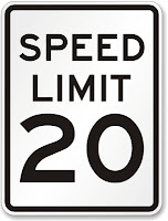
Should Main Street be a 20 MPH street?

Main Street is Laurel's original commercial corridor and currently the only stretch of retail/office that was designed for walk-up traffic.  It has wide sidewalks (up to 10' including the tree boxes).  It is a designated bike route in the City.  The buildings are not set back from the property lines and there are no parking lots in between the road and the building entrances.  In short, it was designed for the people that live on and adjacent to Main street - like a traditional city.  It, however, has a speed limit of 25 mph, which is often the default lowest speed limit assigned to roads.  Residents have often stated that drivers were going too fast on Main Street.  Data shows that the average speed is about 22 MPH with 70% of the traffic traveling below the speed limit. However, a better question may be:  Is 25 mph the correct speed limit for Main Street?

A trend that has been developing in Europe and is just beginning here in the US, is 20 mph streets.  Typically, 25 MPH is the default minimum – often reserved for residential roads, but based largely on the design speed that the roadway was designed for. Somerset, MD, a small lovely residential hamlet in Montgomery County, has made a policy decision to reduce the speed limit for the entire town to 20 MPH. 
This decision was not an engineering one (which typically deals with only the safety of drivers that are already pretty safe wrapped up in a 3000 lb steel box).  Rather, it was a decision based on planning for slower roads and roads that are safer for all users (children, joggers, cyclists, etc.). 
Some of the the positives and negatives of a slower Main Street are:
Positives:
·       Slower speeds making walking more comfortable for pedestrians.
·       Slower speeds are better for bikers (speed differential between cars and bike is a main factor in bicycling level of comfort and broadening its appeal to more users.
·       A pedestrian getting hit at 25 mph has 4-fold higher likelihood of dyeing than at 20 mph.
·       Slower drivers are more apt to see the types of businesses that line Main Street.
·       There is simply no engineering reason to allow/encourage 25mph speeds on Main Street, but there are certainly economic and safety reasons for lowering the speed limit.
Negatives:
·         A driver will need an extra 23 seconds to travel the main retail stretch from MD 216 to US 1.
That’s it.  On the surface, relying on planning and policy, rather than what a roadway could handle, sure seems to be a better way for towns to assign speed limits.


Sunday, March 4, 2012

Links Edition - developing the smart way

Haven't had the time to update this Blog as frequently as I would like.  In reality, I see it morphing toward editorializing and discussion of best practices, rather than an update/discussion on Laurel-specific plans (tough to do the latter when you're no longer in the know).  Strangely, this site gets 300 to 400 hits a month still, mostly from people researching pedestrian and bike safety/infrastructure. Kind of flattering for the City, no?  Regardless, here are some links to articles I've finally gotten around to reading that may be informative to those that still come here:

Tuesday, July 12, 2011

New Pedestrian and Bike Regulations in City Code

As of July 1st, the City of Laurel has adopted a Unified Land Development Code. This new code consolidates and replaces the existing zoning ordinance, subdivision regulations, forest conservation codes, and all other development-related regulations.  Several particular changes have been made in the Code with regard to the way that new developments accommodate and mitigate traffic.  Specifically, developments will now have to accommodate pedestrian and bicycle travel, in addition to the vehicle traffic that developments have traditionally been required to mitigate.  These changes will help provide alternative choices for City residents to get around town. The changes are as follows:
  1. Sec. 20-2.2. (b)(3)  Requires traffic impact studies to look at the effects of bike and pedestrian traffic generated to and from new developments, instead of only vehicle traffic. This will insure that traffic mitigation, if needed, applies to pedestrian and bike traffic, instead of just car traffic.
  2. Sec. 20-16.12. (b), (g)  Reduces and/or consolidates the number of parking lot driveways during redevelopment projects. The purpose of this change was to reduce the number of conflict points the lead to crashes - for cars and for bikes and pedestrians.
  3. Sec. 20-31.5. (b)  All new blocks are now limited in length to 500 feet. The previous limit was 1400 feet. This change encourages shorter blocks to reduce the likelihood of mid-block crossing in commercial areas that get a lot of pedestrian traffic.
  4. Sec. 20-31.1. (c)  For new developments, minor streets are to be designed such that speeding is discouraged. Potential methods, offered by the Code, include traffic calming, sharp corner radii, narrow streets, and bump-outs at intersections. By providing for traffic calming in the design process, it prevents the City from going back and having to retro-fit a speed reduction fix into a neighborhood.
  5. Sec. 20-31.1. (o)  Dead-end streets (e.g. cul-de-sacs) are now prohibited.
  6. Sec. 20-28.7 (e)  Bike Parking requirements: All new multi-family, office and commercial developments must provide bicycle parking. For residential properties, two spaces are required for every five dwelling units (exemptions are made for Single family, duplex, triplex, and townhouse developments are exempt from residential bike parking requirements). For retail and restaurants, two spaces are required for every 2,500 square feet. For all other commercial or office properties, two spaces for every 5,000 square feet. A single rack constitutes two spaces. Bike racks shall be either an “Inverted U-Style (Bike Arch)” type or a “2-Bike Post and Ring” type and have a powder coat finish. Wave or Grid type bike racks are not permitted. Bicycles must be able to be locked in two places. Outdoor bike racks must be located within visual distance of the entrance of the building for which the parking has been designated. Bike parking for office buildings and for residential, if applicable, shall be located indoors. Rack areas located outdoors must be lighted with a minimum foot-candle of 1.0.
  7. Sec. 20-44.6. On new developments, sidewalks are required on both sides for primary and secondary residential streets; the Code previously required sidewalk on only one side. Minimum sidewalk width is now 6' with the exception of residential-only areas. For new developments or redevelopments, roadside hiker-biker trails on property that abuts permittee’s property must be extended, in kind, through permitee’s property in the City’s public right of way. In addition, bike facilities shall be required in the City right-of-way, as referenced in the City of Laurel Bikeway Master Plan.  Bicycle facilities should extend to the nearest intersection on each side of the permittee’s property.   These changes provide for the continuation of investments the City has made in alternative travel modes.

Friday, January 21, 2011

Results from Laurel's Walking Survey

Last November, DPW conducted a survey on the condition of the City's pedestrian infrastructure.  The results of the survey are posted in two parts:  1) Responses to survey questions; and 2) Residents' additional comments.
  • Responses to survey questions can be found HERE,
  • Additional resident comments (along with DPW responses) can be found HERE.
The takeaway from this survey is that there is a big demand for adding to and improving upon our pedestrian infrastructure.  Also, improvements in accessibility, safety, and aesthetics would encourage even more walking.
Thank you to everyone who took the time to respond!

Monday, December 6, 2010

Walk Score Heat Map for City of Laurel

WalkScore has put together "walkability" heat maps for the 2500 largest cities in the US. The maps attempt to quantify, visually, how walkable each neighborhood is within a City.  Here is Laurel's Map or look at other Cities in Maryland.
City of Laurel Walk Score Heat Map

Friday, November 12, 2010

Survey on walking conditions

We are taking a survey of City residents on the condition of our walking infrastructure and how we can improve it.  Please take a moment to fill out our short anonymous SURVEY.
click HERE to take the survey

Survey is now CLOSED.  Thank you for your participation.

Friday, May 28, 2010

How walkable is your neighborhood?

A while back, the good people at Walkscore created a tool that allows users to "measure" the walkability of their house. Users can type in an address at their site or in the "neighborhood walkability" widget on the right-side of this blog.  Their measure of walkability is based on the distance to amenities nearby (i.e. within walking distance), such as grocery stores, restaurants, bars, public transit, schools, pharmacies, parks, etc.

Because The City is compact and has several parks, and schools and shopping centers, many of the City's older neighborhoods - such as Old Town or Fairlawn - score very well.  However, some the new developments are a mixed bag in terms of their walkability score.  The new Archstone-built apartments at the corner of 4th/Cherry and on Contee Road have good scores of 75 out of a 100 and 63 out of 100, respectively.  Meanwhile, the newest developments of Wellington 7 and the Crescent on Cherry Lane fare worse at 45 and 28, respectively, in terms of walkability.

Now, the walkability score is far from perfect. Impediments such as rivers or highways are ignored, as well as, the existence (or lack) of sidewalk or pedestrian-friendly infrastructure.  Fortunately, the City of Laurel has a well built-out sidewalk infrastructure and no large boundaries such as interstates or rivers to impede walking.  So, in general, the higher your walkability score, the closer you are to many amenities. 

Studies (PDF) have shown that, in general, higher walkability scores are correlated with higher home values in Cities.  Based on a random selection of neighborhoods, this does not appear to hold true in the City of Laurel.  With the exception of Old Town, the neighborhoods with lower walkablilty scores tend to be more expensive.  Of course, home size and new construction have a large role in that corollary.

Wednesday, November 25, 2009

Pedestrian Safety (unscientific) Poll Results

Two months ago, this site polled residents on pedestrian safety. Given the size of the city, 27 respondents isn’t statistically significant, but here are the results nonetheless:
  • 25% said “Yes, there is plenty of sidewalk and safe crossings"
  • 33% said “No, too many fast cars”
  • 7%   said “Yes, but more lighting is needed”
  • 22% said “Pedestrian facilities are inadequate”
  • 11% of respondents said that “They don’t walk much through the City”
The City of Laurel regularly addresses the issues listed in this poll through periodic lighting surveys, new sidewalk, speed surveys, new crosswalks, traffic calming, etc.  Since over 60% of respondents felt that pedestrian facilities were inadequate to some degree, we offer a follow-up question:  Assuming you live in the City of Laurel (see Map below), where do you feel that pedestrian facilities are inadequate?


Click to Enlarge